Vittskövle Posten
14 km
Vittskövle Posten
14 km
 Yngsjö skolan
17 km
Yngsjö skolan
17 km
 Åhus Havsvägen
20 km
Åhus Havsvägen
20 km
 Åhus Äspetvägen
20 km
Åhus Äspetvägen
20 km
 Åhus Glashyttan
20 km
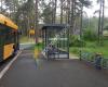
Very nice bus stop. Believe it or not, sometimes you can see a lifetime of live lingo... Åhus Grobladsvägen
21 km
Åhus Vannebergavägen
21 km
Åhus Barkborrevägen
21 km
Åhus Glashyttan
20 km
Very nice bus stop. Believe it or not, sometimes you can see a lifetime of live lingo... Åhus Grobladsvägen
21 km
Åhus Vannebergavägen
21 km
Åhus Barkborrevägen
21 km
 Åhusbryggan
22 km
Nice during the day, of course, but wait until sunset and you'll see. The unbeatable ...
Åhusbryggan
22 km
Nice during the day, of course, but wait until sunset and you'll see. The unbeatable ...to add Tollarp Lundgrens väg map to your website;